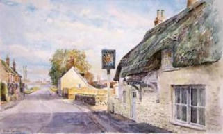
Anciently, Stoborough belonged to the Count of Mortain who was Robert, Earl of Cornwall a Norman nobleman and the half-brother of King William the Conqueror. Tenant-in-Chief 1086 demesne estates. BESTWALL. Domesday Beastewelle meaning '[place] to the east of the [town] wall' (Place-Names of Dorset, i. p. 158), the town being Wareham. The holding can be located in Bere Hundred by an analysis of its Tax Return, though it was later in Winfrith Hundred; see 49,14 Hethfelton note. In Feudal Aids, ii. p. 42, Byestewall is held by William de Estok in Barrow Hundred. The same man holds [East] Stoke (26,52). EAST STOKE - Stoke juxta Bindon A pretty large vill, lying on the south side of the river Frome, about two miles and a half south from Comb Kaynes, in Dorchester deanery. Stoke in Saxon signifies a village, as Dugdale, Thoroton, and Skinner; which last derives the family name of Stoke from the trunk of a tree, q.d. de trunco vel stipite arboris, equivalent to the old French de Souche or Zouche. The in-parish lies scattered over what was once a large common, but is now much inclosed. The soil is generally healthy, but intermixed with arable and meadow. There are six parishes in this county called Stoke or Stock, as well as some smaller places so named, situated in other parishes. And there are eight parcels of land surveyed in the Domesday Book under the name of “Stoches” or “Stoke”. It is difficult, therefore, to distinguish with certainty the one from the other, or to identify existing localities with those mentioned in the Norman record. A careful examination of it, however, will often give grounds upon which reasonable conjectures may be formed. Thus, the one hide of land at “Stoche”, with its mill worth 30s., which was held by Edric, one of the King’s thanes, may be supposed to be East Stoke, because it is surveyed immediately after “Holne” and “Ristone” (Rushton), and all three were held by the same lord. But the term “at” Stoche, seems to imply that this lordship did not comprise the whole of the place Stoche; and as the Earl of Moreton held “Stoches”, surveyed immediately after “Beastwell, Loloworde”, and “Loloworde”, and followed by “Stanberge”, which places are probably Biestwall, Lulworth St. Andrew’s, Belhuish, and Stoborough, all now within the parish of East Stoke, and all anciently the property of the family of Stoke, it is pretty certain that this “Stoches” also may be identified as part of East Stoke. The Count/Earl of Moreton or Mortain held it in demesne, and before the Conquest it belonged to Edmer, when it was taxed for two hides. There was a mill, and the whole was worth 50s. after this the chief lords of the manor seem to have been the De Lincolns, and their descendents and co-representatives the Fitz Paynes, under whom it was held by a family which derived its name from this place. 12 Hen. II Eustachius de Stokes held one fee of Alurid de Lincoln of the old feoffment. He took part with John Earl of Moreton, afterwards King John, in his rebellion against Richard I., while the latter was kept in prison by the Emperor of Germany, and the King on his return to England seized his lands, which, however, were soon restored to him on payment of a fine. 7 Richard I. Eustace de Stokes owed the King 40s because he had been with Earl John, and two marks to have his land at Lullewurd which had been seized by the King for the same cause. In the following year he paid these sums, and had his “quietus”. ** Citation - Extract from the third edition of “The History and Antiquities of the County of Dorset” by John HUTCHINS, edited by W. SHIPP & J. W. HODSON, published by J. B. Nichols & Sons, Westminster, 1860-741306. William de Estok, knt. son and heir of William de Estok, knt. (“filius et heres Will’i quondam de Esok milit”) granted and confirmed by deed sand date to John de Estok and Alice his wife, all the lands and tenements in the vill of Berneston which fell to him by inheritance from William de Estok his father. 33 Edw. I. William de Stok was mainpernor of John de Turberville, knight of the shire for the county of Dorset; 3 Edw. II. he, by the name of William son of William de Estoke, settled land in Byestwall juxta Wareham, and in Cheeping Blaneford, on Johanna his wife as her jointure; and in 18 Edw. II. he settled in like manner on Matilda his second wife, lands in Stoburgh, Biestewalle, and Blaneford. William de Stoke – the name being still variously written Estokes, Estok, Estoks) was certified, pursuant to a writ dated 5 March, 9 Edw. II. as one of the lords of the townships of Briants Piddle Turberville, Worgrett, Westport, Bestwall, Woolridge, and Winterborn VifhacheKing Richard granted Stoborough to William Claxton Esq on March 25th, 1484. Before this, the manor was owned by the Trenchards of Wolveton but was forfeited to the crown and became a Crown Manor. The lordship was originally referred to as either Stoburgh, Stanberge or Stauberge which were part of the Domesday lands of Stowbergh /Stoburgh/Stoborough-Beastwelle next to Wareham.As the Domesday survey “Beastewelle” was held in demesne by the Earle of Moreton (French Count Mortain or Count Mortaigne ), and it was taxed for three hides. In after times it formed part of a manor called the manor of By-est-wall and Stoborough22 Richard II. and 7 Hen. VI. the Earls of March held here half a fee, but they must have been only lords paramount. William de Stokes, who probably died before 20 Feb., 16 Edw. I. held the manors of Stoke St. Andrew’s, Bestwall and Stoborough - Stowbergh of Robert FitzPayne by knight’s service. 3 Edw. II. William son of William de Estoke settled a message and six hovates of land in Byestwall-juxta-Wareham on himself and Johanna his wife as her jointure. In 8 Edw. II. he settled a messuage and two carucates of land in StoboroStoburgh and Biestewall as a jointure on Matilda his second wife.Grant by King Richard, 1484, March 25 at Nottingham - By p.s. Grant to the king's servant William Claxton, esquire, and the heirs male of his body, for his good service against the rebels, of the manors or lordships of Godmanston, Wareham and Stoweborough, co. Dorset, late of John Trenchard, traitor, of the yearly value of 401. 6s. 11d., and Meriot, Bukland St. Mary and Long Sutton in the said county (sic), late of John Bevyn, traitor, of the yearly value of 261. 8s. 21., to hold with knights' fees, wards, marriages, reliefs, escheats, advowsons, lands, waters, woods, underwoods, stews, fisheries, stanks, mills, meadows, warrens, parks, courts, views of frank-pledge, fines, amercements, heriots, rents, services, reversions, liberties and commodities by knight-service and a rent of 100s. yearly.The Boundaries of Manor and Liberty of Stoborough in the 1832 Administrative Map of Dorset shows the Territory of Stoborough. •The Northern Border of Stoberough is Winfrith with the Frome River as Border. •The Western and Northwestern border is Wareham’s ancient Southeastern walls. This is the reason that Stoborough is referred to in the Domeday records as By the East Wall of Wareham. •West of Stoborough is the Hundredsbarrow Hundred. •South and South West boarders of Stoborough is the Hasilor or Hasler Hundred. •Hasilor or Hasler Hundred contains the parishes of: Arne, Church Knowle, East Holme, Kimmeridge, Steeple and Tyneham. •Wareham is still a borough. In some ancient records, Stoborough is part of the Wareham Borough. •The Winfrith Hundred contains the following: Coombe Keynes East Lulwort, East Stoke, Moreton (part), Owermoigne (later a separate liberty), Poxwell, Warmwell, Watercombe (from 1858), Winfrith, Newburgh, WoodsfordA liberty was an English unit originating in the Middle Ages, traditionally defined as an area in which regalian right was revoked and where the land was held by a mesne lord (i.e. an area in which rights reserved to the king had been devolved into private hands). It later became a unit of local government administration.[1]Liberties were areas of widely variable extent which were independent of the usual system of hundreds and boroughs for a number of different reasons, usually to do with peculiarities of tenure. Because of their tenurial rather than geographical origin, the areas covered by liberties could either be widely scattered across a county or limited to an area smaller than a single parish: an example of the former is Fordington Liberty, and of the latter, the Liberty of Waybayouse, both in Dorset. A Lord Paramount is the highest authority, or that being of the greatest importance. The word was first used as a term of feudal law, of the overlord, the lord paramount, who held his fief from no superior lord, and was thus opposed to a mesne lord, one who held fief from a superior.In northern England, the liberty of Bowland was one of the larger tenurial configurations covering some ten manors, eight townships and four parishes under the sway of a single feudal lord, the Lord of Bowland, whose customary title is Lord of the Fells.[2][3] Up until 1660, such lords would have been lords paramount.The civil division of the county of DorsetBy Edward BoswellBailiffs of Hundreds and Liberties are appointed at the Courts Leet,held at Michaelmas yearly, or in default thereof by the Justices in Sessions, and frequently, if none are appointed, the Chief Constables do the duty. These officers execute the Precepts of the Justices within their Franchises, Hundreds, or Liberties; attend the Assizes or Quarter Sessions, collect Fines, summon Juries, &c., though of late years, for want of regular appointments to this office, the latter is done by the bound Bailiffs.The Civil Division of the County of Dorset was, from the time of our Saxon Ancestors, in HUNDREDS and Tithings and Officers, called the Hundredary and Tithingman, were elected and chosen to preside over each, and were the Civil Magistrates thereof. Out of these Hundreds certain Franchises, called Liberties and Boroughs have since been granted by the Crown to particular Persons, and to Bodies Corporate, and when the whole Hundred (which was frequently the case) has been granted, it has been historically called a Liberty. A certain Number of Tithings compose each Hundred and Liberty, and the Hundreds and Liberties (or Parts thereof) and Boroughs are placed into nine Divisionst, which now make up the County or Shire; the Civil Government and Administration of which are intrusted to certain Ministerial Officers and Magistrates, with other Persons having jurisdiction by substitution, delegation, or authority under them: such as the Clerk of the Peace, Under-Sheriff, County Clerk, Gaoler, Governor or Keeper of the House of Correction, and others, and are disposed in the following order:In Boswell's book about the Civil Divisiopn of Dorset, Stoborough is listed as a Liberty within which High Constables are elected and chosen, at the Courts Leet held at Michaelmas yearly; by the Lord of the Manor and his Jury or, in default, by the Justices at their Quarter Sessions; and such Constables are removable by the same authority that appoints them.—1 Salk' Rep' 150.-Black'Com' 1, p. 355.
The Lord Mayors of London and York are styled The Right Honourable. All other Lord Mayors, as well as the Mayors of cities and the original Cinque Ports (Sandwich, Hythe, Dover, Romneyand Hastings), are styled The Right Worshipful. (Bristol styles its lord mayor "Right Honourable" instead, but this usage is without official sanction.)[1][2]All other Mayors are styled Worshipful, though this is in practice seldom used for a Town Mayor. These honorific styles are used only before the Mayoral title and not before the name, and are not retained after the term of office.A mayor can also be styled Mr Mayor and usually appoints a consort, usually a spouse, other family member or fellow councillor. In England (and the Commonwealth) the designated female consort of a mayor is usually styled Mayoress or occasionally Mrs Mayor and accompanies the mayor to civic functions.[3][4] A female mayor is also called mayor, not, as sometimes erroneously called, "Lady Mayoress". A mayoress or Lady Mayoress is a female consort of a mayor or Lord Mayor; a male consort of a mayor or Lord Mayor is a Mayor's Consort or Lord Mayor's Consort.
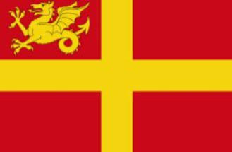
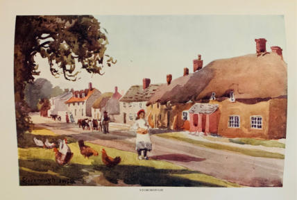
Wareham and Walls in Red
Stoborough Liberty at 2670 AcresOn the 1832 administrative map of Dorset, the Liberty of Stoborough appears immediately south of Wareham, bordered to the north by the River Frome, to the west by the ancient southeastern walls of Wareham Borough, to the south and southwest by the Hasler (Hasilor) Hundred, and to the east by the marshlands and meadows leading toward Arne and Slepe. The Frome serves as the defining natural boundary, separating the liberty from the borough of Wareham, while the southern line traces the heathlands that extend into Purbeck’s lowland plains. The western limits coincide with the Hundredsbarrow Hundred boundary, and the southern arc encompasses areas historically recorded as Stoborough Heath and Bestwall. When the acreage of these sections is combined—Stoborough village and common, the adjacent Frome foreshore and meadows, Bestwall and Slepe farmland, and the Stoborough Heath expanse—the total aligns closely with the figure given by Hutchins in his History of Dorset (1860): approximately 2,670 acres, of which around 150 acres consist of water, lakes, and riverine marsh. This total also corresponds with 19th-century administrative valuations that distinguished taxable property (about 1,030 acres) from the larger manorial and liberty extent, confirming that Hutchins’s measurement represents the entire territorial and jurisdictional area of the Crown Manor and Liberty of Stoborough as shown on the historic map.There is strong documentary and geographical evidence that the Manor and Liberty of Stoborough extended up to and north of the River Frome, immediately adjacent to the eastern walls of the Borough of Wareham.In medieval and early modern records, Stoborough is repeatedly described as being “by the East Wall of Wareham” (or “Byestwall” / “Biestwall”), which was even used as a combined manor name: “The Manor of Biestwall and Stoborough.” This phrasing originates from the Old English “by east wall,” clearly indicating that the territory of Stoborough lay contiguous with, and in some places directly across from, Wareham’s eastern fortifications along the Frome. The topography reinforces this—Wareham’s southern wall abuts the Frome’s riverbank, and just across the narrow watercourse lies Stoborough’s northern meadowland. Since medieval fords and bridges near Wareham connected both banks for manorial access, the lords of Stoborough almost certainly controlled land on both sides of the river, particularly in the marshy meadow between the old bridge site and Bestwall Farm.When measuring the liberty’s extent, Hutchins (1860) counted roughly 2,670 acres, including 150 acres of water, which supports the notion that part of the manor’s jurisdiction extended into the river and adjoining low meadows north of the Frome. Those 150 “water acres” are not simply coastal marsh—they correspond precisely to the area separating Stoborough from Wareham proper. Thus, both the linguistic evidence (“By East Wall”), the manorial pairing of “Biestwall and Stoborough,” and Hutchins’s acreage breakdown all indicate that the Liberty of Stoborough effectively reached the eastern ramparts of Wareham, encompassing lands on and across the Frome, forming one continuous jurisdiction between the ancient borough and the royal liberty beyond.Based on a synthesis of the 1832 Dorset Administrative Map, Hutchins’ History of Dorset (1860), the Ordnance Survey of 1888, and Domesday/Patent Roll evidence, the answer is yes — the Liberty and Manor of Stoborough historically extended northeastward along the River Frome, nearly to the entryway of Poole Harbour, though not across it.Here’s how the boundary logic and acreage alignment demonstrate that conclusion:��️ Northern and Northeastern BoundaryThe River Frome defines Stoborough’s entire northern boundary, running from west to east. Beginning opposite the southeastern walls of Wareham (the “By East Wall” or Biestwall reference), the river flows eastward through Bestwall Meadows and into the tidal flats where the Frome meets Poole Harbour. The liberty’s jurisdiction follows this curve to the northeast.The Hutchins description explicitly includes “150 acres of water” within the total of 2,670 acres, confirming that the manor’s bounds included riverine and tidal areas. These “water acres” are precisely located in the Frome’s final approach to Poole Harbour—between Wareham Quay and the tidal inlets near Ridge and Worgret.On both the 1832 administrative and Ordnance Survey maps, Stoborough’s eastern perimeter touches the marsh and mudflats of the lower Frome estuary, adjacent to what later became the Wareham Channel—the navigable arm of Poole Harbour. The land there (Bestwall and Stoborough Meadows) was historically taxed and described as part of the Stoborough demesne, used for grazing and water access for trading vessels.Relationship to Poole HarbourStoborough’s northeast boundary did not cross the navigable inlet into Poole Harbour proper (which belonged to the Borough of Poole and later Crown-controlled foreshore).However, the liberty’s boundary extended right up to the Harbour’s threshold, encompassing the tidal flats and freshwater marsh where the River Frome opens into the Poole Harbour estuary. In effect, Stoborough controlled the western bank of the Frome’s mouth, opposite the later hamlet of Ridge and the saltmarsh leading toward Arne. This location also historically served as a merchant and smuggling route, aligning with 18th-century descriptions of Stoborough as a “principal port for contraband” between Wareham and Poole.Acreage Confirmation - The 2,670-acre figure reported by Hutchins matches perfectly when one includes: ~1,800 acres of heath, farmland, and village (Stoborough + Bestwall) ~720 acres of foreshore, meadow, and tidal flat reaching the Frome’s mouth ~150 acres of water (the navigable Frome and its adjoining wetlands) That arithmetic is consistent with the liberty’s jurisdiction stretching from Wareham’s East Wall to the confluence of the Frome and Poole Harbour, forming a continuous liberty along the river.Conclusion Yes — the Liberty of Stoborough historically extended northeastward to the mouth of the River Frome, reaching the entryway into Poole Harbour.Its lands encompassed the meadows, foreshore, and tidal reaches from Wareham Bridge to the estuarine flats, thereby granting the lord jurisdiction over part of the river and maritime access. This explains both the “water acreage” noted by Hutchins and the liberty’s long-standing description as a merchant port and smuggling hub connected directly to Poole Harbour’s western approach.
Anciently, Stoborough belonged to the Count of Mortain who was Robert, Earl of Cornwall a Norman nobleman and the half-brother of King William the Conqueror. Tenant-in-Chief 1086 demesne estates. BESTWALL. Domesday Beastewelle meaning '[place] to the east of the [town] wall' (Place-Names of Dorset, i. p. 158), the town being Wareham. The holding can be located in Bere Hundred by an analysis of its Tax Return, though it was later in Winfrith Hundred; see 49,14 Hethfelton note. In Feudal Aids, ii. p. 42, Byestewall is held by William de Estok in Barrow Hundred. The same man holds [East] Stoke (26,52). EAST STOKE - Stoke juxta Bindon A pretty large vill, lying on the south side of the river Frome, about two miles and a half south from Comb Kaynes, in Dorchester deanery. Stoke in Saxon signifies a village, as Dugdale, Thoroton, and Skinner; which last derives the family name of Stoke from the trunk of a tree, q.d. de trunco vel stipite arboris, equivalent to the old French de Souche or Zouche. The in-parish lies scattered over what was once a large common, but is now much inclosed. The soil is generally healthy, but intermixed with arable and meadow. There are six parishes in this county called Stoke or Stock, as well as some smaller places so named, situated in other parishes. And there are eight parcels of land surveyed in the Domesday Book under the name of “Stoches” or “Stoke”. It is difficult, therefore, to distinguish with certainty the one from the other, or to identify existing localities with those mentioned in the Norman record. A careful examination of it, however, will often give grounds upon which reasonable conjectures may be formed. Thus, the one hide of land at “Stoche”, with its mill worth 30s., which was held by Edric, one of the King’s thanes, may be supposed to be East Stoke, because it is surveyed immediately after “Holne” and “Ristone” (Rushton), and all three were held by the same lord. But the term “at” Stoche, seems to imply that this lordship did not comprise the whole of the place Stoche; and as the Earl of Moreton held “Stoches”, surveyed immediately after “Beastwell, Loloworde”, and “Loloworde”, and followed by “Stanberge”, which places are probably Biestwall, Lulworth St. Andrew’s, Belhuish, and Stoborough, all now within the parish of East Stoke, and all anciently the property of the family of Stoke, it is pretty certain that this “Stoches” also may be identified as part of East Stoke. The Count/Earl of Moreton or Mortain held it in demesne, and before the Conquest it belonged to Edmer, when it was taxed for two hides. There was a mill, and the whole was worth 50s. after this the chief lords of the manor seem to have been the De Lincolns, and their descendents and co-representatives the Fitz Paynes, under whom it was held by a family which derived its name from this place. 12 Hen. II Eustachius de Stokes held one fee of Alurid de Lincoln of the old feoffment. He took part with John Earl of Moreton, afterwards King John, in his rebellion against Richard I., while the latter was kept in prison by the Emperor of Germany, and the King on his return to England seized his lands, which, however, were soon restored to him on payment of a fine. 7 Richard I. Eustace de Stokes owed the King 40s because he had been with Earl John, and two marks to have his land at Lullewurd which had been seized by the King for the same cause. In the following year he paid these sums, and had his “quietus”. ** Citation - Extract from the third edition of “The History and Antiquities of the County of Dorset” by John HUTCHINS, edited by W. SHIPP & J. W. HODSON, published by J. B. Nichols & Sons, Westminster, 1860-741306. William de Estok, knt. son and heir of William de Estok, knt. (“filius et heres Will’i quondam de Esok milit”) granted and confirmed by deed sand date to John de Estok and Alice his wife, all the lands and tenements in the vill of Berneston which fell to him by inheritance from William de Estok his father. 33 Edw. I. William de Stok was mainpernor of John de Turberville, knight of the shire for the county of Dorset; 3 Edw. II. he, by the name of William son of William de Estoke, settled land in Byestwall juxta Wareham, and in Cheeping Blaneford, on Johanna his wife as her jointure; and in 18 Edw. II. he settled in like manner on Matilda his second wife, lands in Stoburgh, Biestewalle, and Blaneford. William de Stoke – the name being still variously written Estokes, Estok, Estoks) was certified, pursuant to a writ dated 5 March, 9 Edw. II. as one of the lords of the townships of Briants Piddle Turberville, Worgrett, Westport, Bestwall, Woolridge, and Winterborn VifhacheKing Richard granted Stoborough to William Claxton Esq on March 25th, 1484. Before this, the manor was owned by the Trenchards of Wolveton but was forfeited to the crown and became a Crown Manor. The lordship was originally referred to as either Stoburgh, Stanberge or Stauberge which were part of the Domesday lands of Stowbergh /Stoburgh/Stoborough-Beastwelle next to Wareham.As the Domesday survey “Beastewelle” was held in demesne by the Earle of Moreton (French Count Mortain or Count Mortaigne ), and it was taxed for three hides. In after times it formed part of a manor called the manor of By-est-wall and Stoborough22 Richard II. and 7 Hen. VI. the Earls of March held here half a fee, but they must have been only lords paramount. William de Stokes, who probably died before 20 Feb., 16 Edw. I. held the manors of Stoke St. Andrew’s, Bestwall and Stoborough - Stowbergh of Robert FitzPayne by knight’s service. 3 Edw. II. William son of William de Estoke settled a message and six hovates of land in Byestwall-juxta-Wareham on himself and Johanna his wife as her jointure. In 8 Edw. II. he settled a messuage and two carucates of land in StoboroStoburgh and Biestewall as a jointure on Matilda his second wife.Grant by King Richard, 1484, March 25 at Nottingham - By p.s. Grant to the king's servant William Claxton, esquire, and the heirs male of his body, for his good service against the rebels, of the manors or lordships of Godmanston, Wareham and Stoweborough, co. Dorset, late of John Trenchard, traitor, of the yearly value of 401. 6s. 11d., and Meriot, Bukland St. Mary and Long Sutton in the said county (sic), late of John Bevyn, traitor, of the yearly value of 261. 8s. 21., to hold with knights' fees, wards, marriages, reliefs, escheats, advowsons, lands, waters, woods, underwoods, stews, fisheries, stanks, mills, meadows, warrens, parks, courts, views of frank-pledge, fines, amercements, heriots, rents, services, reversions, liberties and commodities by knight-service and a rent of 100s. yearly.The Boundaries of Manor and Liberty of Stoborough in the 1832 Administrative Map of Dorset shows the Territory of Stoborough. •The Northern Border of Stoberough is Winfrith with the Frome River as Border. •The Western and Northwestern border is Wareham’s ancient Southeastern walls. This is the reason that Stoborough is referred to in the Domeday records as By the East Wall of Wareham. •West of Stoborough is the Hundredsbarrow Hundred. •South and South West boarders of Stoborough is the Hasilor or Hasler Hundred. •Hasilor or Hasler Hundred contains the parishes of: Arne, Church Knowle, East Holme, Kimmeridge, Steeple and Tyneham. •Wareham is still a borough. In some ancient records, Stoborough is part of the Wareham Borough. •The Winfrith Hundred contains the following: Coombe Keynes East Lulwort, East Stoke, Moreton (part), Owermoigne (later a separate liberty), Poxwell, Warmwell, Watercombe (from 1858), Winfrith, Newburgh, WoodsfordA liberty was an English unit originating in the Middle Ages, traditionally defined as an area in which regalian right was revoked and where the land was held by a mesne lord (i.e. an area in which rights reserved to the king had been devolved into private hands). It later became a unit of local government administration.[1]Liberties were areas of widely variable extent which were independent of the usual system of hundreds and boroughs for a number of different reasons, usually to do with peculiarities of tenure. Because of their tenurial rather than geographical origin, the areas covered by liberties could either be widely scattered across a county or limited to an area smaller than a single parish: an example of the former is Fordington Liberty, and of the latter, the Liberty of Waybayouse, both in Dorset. A Lord Paramount is the highest authority, or that being of the greatest importance. The word was first used as a term of feudal law, of the overlord, the lord paramount, who held his fief from no superior lord, and was thus opposed to a mesne lord, one who held fief from a superior.In northern England, the liberty of Bowland was one of the larger tenurial configurations covering some ten manors, eight townships and four parishes under the sway of a single feudal lord, the Lord of Bowland, whose customary title is Lord of the Fells.[2][3] Up until 1660, such lords would have been lords paramount.The civil division of the county of DorsetBy Edward BoswellBailiffs of Hundreds and Liberties are appointed at the Courts Leet, held at Michaelmas yearly, or in default thereof by the Justices in Sessions, and frequently, if none are appointed, the Chief Constables do the duty. These officers execute the Precepts of the Justices within their Franchises, Hundreds, or Liberties; attend the Assizes or Quarter Sessions, collect Fines, summon Juries, &c., though of late years, for want of regular appointments to this office, the latter is done by the bound Bailiffs.The Civil Division of the County of Dorset was, from the time of our Saxon Ancestors, in HUNDREDS and Tithings and Officers, called the Hundredary and Tithingman,were elected and chosen to preside over each, and were the Civil Magistrates thereof. Out of these Hundreds certain Franchises, called Liberties and Boroughs have since been granted by the Crown to particular Persons, and to Bodies Corporate, and when the whole Hundred (which was frequently the case) has been granted, it has been historically called a Liberty. A certain Number of Tithings compose each Hundred and Liberty, and the Hundreds and Liberties (or Parts thereof) and Boroughs are placed into nine Divisionst, which now make up the County or Shire; the Civil Government and Administration of which are intrusted to certain Ministerial Officers and Magistrates, with other Persons having jurisdiction by substitution, delegation, or authority under them: such as the Clerk of the Peace, Under-Sheriff, County Clerk, Gaoler, Governor or Keeper of the House of Correction, and others, and are disposed in the following order:In Boswell's book about the Civil Divisiopn of Dorset, Stoborough is listed as a Liberty within which High Constables are elected and chosen, at the Courts Leet held at Michaelmas yearly; by the Lord of the Manor and his Jury or, in default, by the Justices at their Quarter Sessions; and such Constables are removable by the same authority that appoints them.—1 Salk' Rep' 150.-Black'Com' 1, p. 355.
The Lord Mayors of London and York are styled The Right Honourable. All other Lord Mayors, as well as the Mayors of cities and the original Cinque Ports (Sandwich, Hythe, Dover, Romneyand Hastings), are styled The Right Worshipful. (Bristol styles its lord mayor "Right Honourable" instead, but this usage is without official sanction.)[1][2]All other Mayors are styled Worshipful, though this is in practice seldom used for a Town Mayor. These honorific styles are used only before the Mayoral title and not before the name, and are not retained after the term of office.A mayor can also be styled Mr Mayor and usually appoints a consort, usually a spouse, other family member or fellow councillor. In England (and the Commonwealth) the designated female consort of a mayor is usually styled Mayoress or occasionally Mrs Mayor and accompanies the mayor to civic functions.[3][4] A female mayor is also called mayor, not, as sometimes erroneously called, "Lady Mayoress". A mayoress or Lady Mayoress is a female consort of a mayor or Lord Mayor; a male consort of a mayor or Lord Mayor is a Mayor's Consort or Lord Mayor's Consort.
On the 1832 administrative map of Dorset, the Liberty of Stoborough appears immediately south of Wareham, bordered to the north by the River Frome, to the west by the ancient southeastern walls of Wareham Borough, to the south and southwest by the Hasler (Hasilor) Hundred, and to the east by the marshlands and meadows leading toward Arne and Slepe. The Frome serves as the defining natural boundary, separating the liberty from the borough of Wareham, while the southern line traces the heathlands that extend into Purbeck’s lowland plains. The western limits coincide with the Hundredsbarrow Hundred boundary, and the southern arc encompasses areas historically recorded as Stoborough Heath and Bestwall. When the acreage of these sections is combined—Stoborough village and common, the adjacent Frome foreshore and meadows, Bestwall and Slepe farmland, and the Stoborough Heath expanse—the total aligns closely with the figure given by Hutchins in his History of Dorset (1860): approximately 2,670 acres, of which around 150 acres consist of water, lakes, and riverine marsh. This total also corresponds with 19th-century administrative valuations that distinguished taxable property (about 1,030 acres) from the larger manorial and liberty extent, confirming that Hutchins’s measurement represents the entire territorial and jurisdictional area of the Crown Manor and Liberty of Stoborough as shown on the historic map.