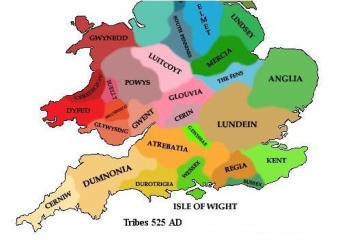
More about The Isle of Purbeck, Dorsetshire
Ancient Feudal Lordship and former “Crown Manor” of Stoborough
The Manor of Stoborough (Part of Ancient Feudal Wareham) lies in one of the wildest and beautiful parts of the Dorsetshire.

Map of Dorsetshire
The Romans arrived in Dorset during their conquest of Britain in AD
43 and called it Durnovaria. By the end of the 7th century Dorset had
fallen under Saxon control and been incorporated into the Kingdom
of Wessex. Stoborough is on the river Frome on the penninsula or
Island of Purbeck, and has access to the sea.
Stoborough Nature
A SSSI area of woods and wet and dry heathland with dartford
warblers, skylarks and nightjars as the main avian attractions. Insect
lovers may bump into the intriguing named wartbiter cricket.
Administered via the RSPB Arne reserve in Poole harbour.

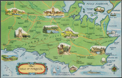
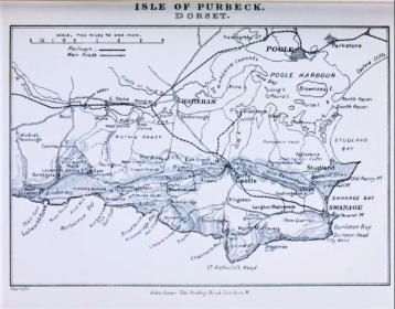
Dorsetshire Map with “Isle of Purbeck”
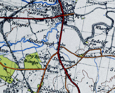
Celtic Kingdom of Durotricia
In 1870-72, John Marius Wilson's Imperial Gazetteer of England and
Wales described Stoborough like this: STOBOROUGH, a liberty in
Wareham-Holy Trinity parish, Dorset; within Wareham borough. Real
property, £1,030. Pop., 346. Houses, 81.
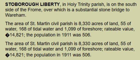
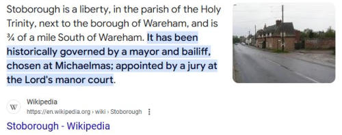
STOBOROUGH, a liberty, in the parish of the Holy Trinity, borough of
WAREHAM, Wareham Division, of the county of DORSET. It was
historically governed by a court leet and mayor, chosen annually at
Michaelmas.
As the Domesday survey “Beastewelle” was held in demesne by
the Earle of Moreton, and it was taxed for three hides. In after times
it formed part of a manor called the manor of By-est-wall and
Stoborough. “Beastewelle, Lolowerde, Loloworde, Stoches,” and
“Stanberge,” are surveyed consecutively in Domesday. One of these
Lolowordes was probably Lullworth St. Andrew’s, the other may
possibly be Belhuish, both Lullworth St. Andrew’s and Belhuish being
in the parish of East Stoke; and Stanberge, though supposed by
Hutchins to be Stanbridge in Little Hinton, was no doubt Stanberge
or Stowborough, part of which is in the same parish. All were held in
demesne by the Earl of Moreton. Both Beastewelle and Stoches
belonged to Edmer in the time of the Confessor, and all in after times
were the property of the family of De Stoke.
The co-heirs of Chauntmarle married William Cheverel and John
Jordan, and the estates of the Stoke family being partitioned between
them, the manor of Biestwall and Stoborough came to the
Trenchards of Wolveton and Lytchett in right of Christian, wife of
Henry Trenchard, daughter and heir of John Mohun by Johanna
daughter and heir of John Jordan of Wolveton.
Stowborough, Great part of Stowborough Manor is in the parish of
the Holy Trinity in Wareham, but the western portion of the Lordship
boundaries is in the parish of East Stoke. There are many historical
references to “Stanberge” in the Domesday Dorset lists. It is variously
spelled Stoburgh and Stauberge, and it afterwards formed part
of a manor styled the manor of Bestwall and Stoborough. Later
to be the Manor of Stoborough which included the Liberty and Court
Leet.
https://www.opcdorset.org/EastStoke/EastStoke-Hutchins.htm
King Richard, 1484, March 25 at Nottingham
By p.s. Grant to the king's servant William Claxton, esquire, and the
heirs male of his body, for his good service against the rebels, of the
manors or lordships of Godmanston, Wareham and Stoweborough,
co. Dorset, late of John Trenchard, traitor, of the yearly value of 401.
6s. 11d., and Meriot, Bukland St. Mary and Long Sutton in the said
county (sic), late of John Bevyn, traitor, of the yearly value of 261. 8s.
21., to hold with knights' fees, wards, marriages, reliefs, escheats,
advowsons, lands, waters, woods, underwoods, stews, fisheries,
stanks, mills, meadows, warrens, parks, courts, views of frank-pledge,
fines, amercements, heriots, rents, services, reversions, liberties and
commodities by knight-service and a rent of 100s. yearly.
Etymology
'Stony hill or barrow', v. stān , beorg , cf. Warham par. infra .For the
loss of ME -n - before a labial consonant, cf. W Stafford par. infra ; for
the replacement of the second el. by burh 'fortification', cf.
Charborough in Morden par. infra . There was a mill here in 1086 DB
(VCHDo 387), cf. the mention of a water mill here or in Worgret infra
in 1409 Hutch3 1415.
Did the Vikings invade Wareham?
The Siege of Wareham and Stoborough occurred in 875 during the
Viking invasions of England. The Viking army of Guthrum captured
the Anglo-Saxon fortress of Wareham from Wessex at the start of his
campaign to conquer the kingdom, which would ultimately be
defeated at the Battle of Edington.
What river runs through Stoborough Wareham?
Stoborough is built on a strategic dry point between the River Frome
and the River Piddle at the head of the Wareham Channel of Poole
Harbour. The Frome Valley runs through an area of unresistant sand,
clay and gravel rocks, and much of its valley has wide flood plains and
marsh land.
Did the Vikings land in Stoborough ?
Dr Britt Baillie, from the University of Cambridge, said: “The whole
Viking period started here in Dorset, as the first recorded Viking raid
on England took place on Portland with three ships landing here in
789.”
Does Stoborough Manor have rivers and lakes and Yacht Clubs?
Yes, Stoborough Manor includes the Frome River and entry way to
Poole Harbor which is the 2nd largest natural harbor in the world.
Stoborough Manor actually has Marinas and Beaches on the river
and on the harbor - It appears that the Redclyffe Yacht Club and
Ridge Wharf Yacht Center are part of the ancient territory of the:
Stoborough Manor & Liberty.
https://www.theguardian.com/travel/2011/jul/14/secret-beaches-
southwest-shipstal-poole
Lords of the Manor and Liberty of Stoborough (Chronological
Order)
1
Count Robert of Mortain
Earl of Cornwall, half-brother of
William the
Conqueror
c. 1086
Held Stoborough (“Stanberge” / “Stowbergh”)
in demesne
as Tenant-in-Chief; had a mill in Stanberge; recorded in the
Domesday Book.
2
William de Stokes (under Robert FitzPayne)
Knight holding
of the FitzPayne
family
c. 1300
Held the manors of Stoke, Bestwall, and
Stoborough by knight’s
service under Robert FitzPayne; under the overlordship of the Earls
of March.
3
John Chauntmarle
Lord of Stoke and Biestwall/Stoborough
Early 1400s
United control of Stoke and Stoborough; one of Dorset’s
medieval gentry
families.
4
The Trenchards of Lytchett
Lords by inheritance
c.
1439–late 1400s
Inherited through the Chauntmarle daughters and their
husbands, the
Jurdons/Jurdaine; later forfeited the manor to the Crown.
5
William Claxton, Esquire
Crown Grantee of Richard III
1484
Granted “the
Crown Manor and Liberty of Stoborough” by King Richard III (Patent
Rolls, 1484).
6
The Crown (Reversion)
Crown holding
Late 15th–16th c.
After
Claxton’s tenure, Stoborough reverted to Crown ownership.
7
Sir William Pitt
Clerk of the Exchequer, MP for Wareham
1591–1636
Granted the manor by Queen Elizabeth I; became Comptroller
of the
Household to King James I; owned Stratfield Saye.
8
Edward Pitt
MP for Poole, Teller of the Exchequer
1636–1643
Son and heir
of Sir William Pitt; seized and imprisoned during the Civil War; died
1643; estates
pillaged by Parliamentarians.
9
The Pitt Family (heirs of Edward Pitt)
Lords by inheritance
1643–1850
The Pitt line retained the manor for nearly 200 years; later
styled Lords Rivers
of Stratfield Saye.
10
George Pitt, 1st Baron Rivers
Baron Rivers of Stratfield Saye
Late 18th –
mid-19th century
Owner of Stoborough, Arne, and Slepe; sold the
estate in 1850 to
the Trustees of the Earl of Eldon.
11
John Scott, 3rd Earl of Eldon
Earl of Eldon
1850–1873
Purchased
the Crown Manor from Lord Rivers’s trustees; residence at Encombe
House, Corfe
Castle.
12
Sir Ernest Stowell Scott KCMG
Second son of the 3rd Earl of
Eldon;
Governor of Jamaica
1873–1953
Inherited Stoborough; continued
the Eldon-
Scott family’s stewardship of the manor.
13
David Eldon Scott
Great-nephew of Sir Ernest Scott
1953–2001
Lived
at Encombe House; last of the Scott line to hold the lordship before
sale; offered
Stoborough title for sale in 2001.
14
Commissioner George Sherwood Mentz, JD MBA DSS
Seigneur of Fief
Blondel, Seigneur of L’Eperons (Guernsey), Lord of Ennerdale
2021–Present
Acquired the Crown Manor and Liberty of Stoborough in fee simple;
holds
court leet and baron rights; current Lord of Stoborough, continuing
the ancient
Wessex lineage.
.
.
.
.
.
.



King Richard, 1484, March 25 at Nottingham
Kings Barrow
The ancient burial places of Danes or Vikings occurred in the
Manor of Stoborough.
The monument includes a bowl barrow situated on a low ridge
occupying the northern edge of Stoborough Heath within the Isle
of Purbeck, overlooking the Frome Valley to the north. The site,
which is known as the King's Barrow, has a mound composed of
earth, sand and turf with a maximum diameter of 20m and a
maximum height of c.1.5m. This is surrounded by a ditch from
which material was quarried during the construction of the
monument. This has become infilled over the years, but will survive
as a buried feature 2m wide. The barrow was partly excavated
during 1767 when a primary inhumation without a skull was found
wrapped in stitched animal skins within a hollowed out wooden
coffin which was 3m long, 1.2m wide and 0.9m deep and
orientated north west by south east. The burial was associated
with a probable shale cup; this has since been lost, although
illustrations suggest that it was decorated with incised lines.
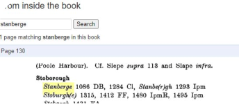
Stanberge
1086
DB
1284
Cl
Stanbe(r)gh
1293
Ipm
Stabergh
1253
Drew
1280
Ass
14
Wim
1319
MinAcct
Staberge
p1483
Sheen
Stoburgh(e)
1315,1412
FF
Stoburgh(e) iuxta Warham
1477
DCMDeed
1483
MinAcct
1495
Ipm
Stobargh
1431
FA
Stobor(r)o(u)gh(e)
1512,1546
Ct
1585,1632
Pitt
Borough of Stoburgh
1664
HTax
Stobroghe
1513
Ct
Stobrowe
1545
ib
Stoburrough
1624
DCMDeed
Stoborrow
1707
Eg
Stoughborough
1515
Ct
Stowboro(we)
1535
Ct
1575
Saxton
c.1586
Tres
Stowborough
1773
Bayly
Stouborowe
1539
Ct
Stoveberowe
c.1628
Strode

Lords of Stoborough in order, numbered from the 1st Lord (1086) through the
present 14th Lord (2021–).


